We reconstructed landscapes that greeted the first humans in Australia around 65,000 years ago
- Written by: Tristan Salles, Associate professor, University of Sydney
Seventy thousand years ago, the sea level was much lower than today. Australia, along with New Guinea and Tasmania, formed a connected landmass known as Sahul. Around this time[1] – approximately 65,000 years ago – the first humans arrived in Sahul, a place previously devoid of any hominin species.
Due to the patchy nature of the archaeological record, researchers still don’t have a full picture of the routes and speed of human migration across the region.
In research published in Nature Communications[2], our team has reconstructed the evolution of the landscape during this time. This allowed us to better understand the migration strategies of the first peoples in what is now Australia, along with the places they lived.
Read more: Fifty years ago, at Lake Mungo, the true scale of Aboriginal Australians' epic story was revealed[3]
Walking over a changing landscape
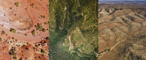
When trying to understand the dispersion of first humans in Sahul, one overlooked aspect has been the impact of the changing landscape itself.
Our planet’s surface is constantly shifted by various physical, climatic and biological processes, changing on a grand scale over geological time – a process known as landscape evolution.
We used a landscape evolution model[4] that details climatic evolution from 75,000 to 35,000 years ago.
The model allows for a more realistic description of the terrains and environments inhabited by the first hunter-gatherer communities as they traversed Sahul.
Read more: Scientists just revealed the most detailed geological model of Earth's past 100 million years[5]
On top of the evolving landscape, we then ran thousands of simulations, each describing a possible migration route.
We considered two entry points into Sahul: a northern route through West Papua (entry time: 73,000 years) and a southern one from the Timor Sea shelf (entry time: ~75,000 years).

From these simulations, we calculated the speeds of migration based on available archaeological sites. Estimated speeds range between 0.36 and 1.15 kilometres per year. This is similar to previous estimates[6], suggesting people spread across the continent quite rapidly.
For both scenarios, our simulations also predicted a high likelihood of human occupation at many of the iconic Australian archaeological sites.
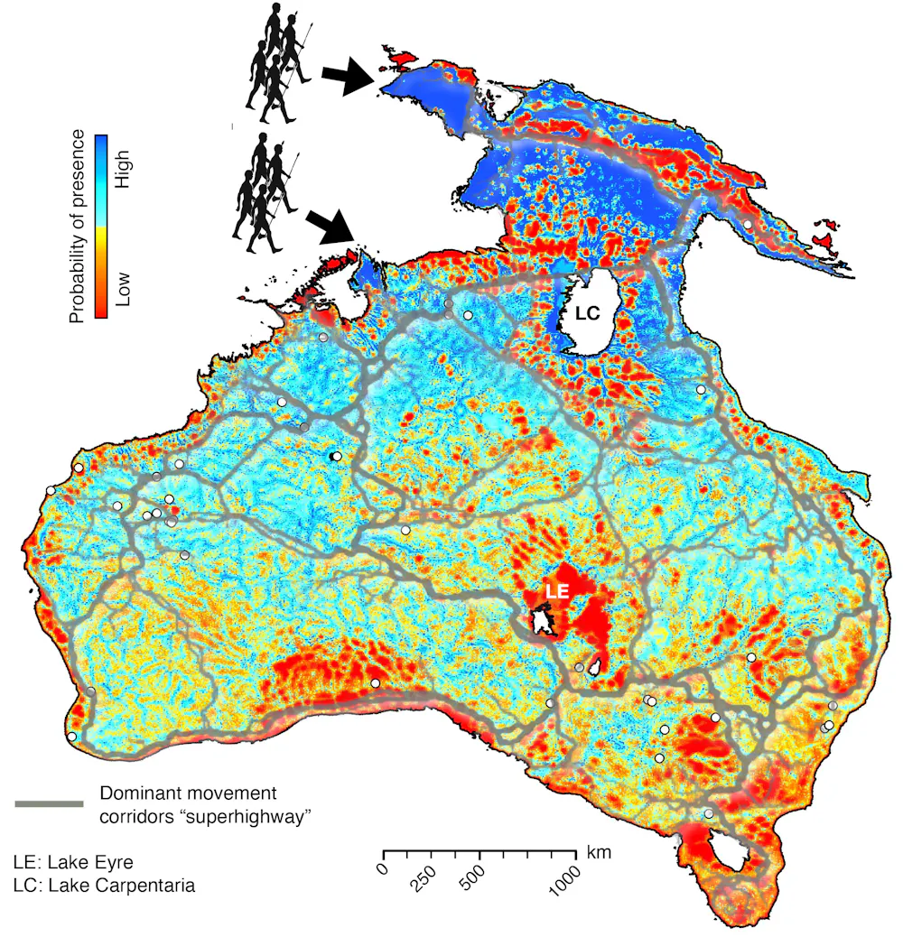 Probability of human presence across Sahul by 35,000 years ago, combining the northern and southern entry points. White circles indicate locations of archaeological sites. Grey lines overlaying the map show the dominant movement corridors interpreted as super-highways of human migration across Sahul before 50,000 years ago.
Salles et al., Nature Communications (2024)
Probability of human presence across Sahul by 35,000 years ago, combining the northern and southern entry points. White circles indicate locations of archaeological sites. Grey lines overlaying the map show the dominant movement corridors interpreted as super-highways of human migration across Sahul before 50,000 years ago.
Salles et al., Nature Communications (2024)
Following rivers and coastlines
From the predicted migration routes, we produced a map of most likely visited regions, with probability of human presence as shown above.
We found that human settlers would have dispersed across the continental interior along rivers on both sides of Lake Carpentaria (the modern Gulf of Carpentaria). The first communities would have mainly been foraging along the way, following water streams. They also travelled along the receding coastlines as sea levels rose once more.
Based on our model, we didn’t identify well-defined migration routes. Instead, we saw a “radiating wave” of migrations.
However, our model did indicate a high likelihood of human presence near several already-proposed most likely pathways of Indigenous movement (called super-highways), including those to the east of Lake Carpentaria, along the southern corridors south of Lake Eyre, and traversing the Australian interior.
Read more: We mapped the 'super-highways' the First Australians used to cross the ancient land[7]
We could predict archaeological sites
There’s one particularly interesting outcome from our map that shows the probability of human presence in Sahul. In a cost-effective way (without needing to travel across the entire continent), it could potentially pinpoint areas of archaeological significance.
Our approach can’t tell us how well a given location might be preserved for archaeological finds. However, our simulations do give an indication of how much specific sites may have eroded or received extra sediment.
We could use this to estimate if artefacts at a potential archaeological site have moved or been buried over time.
Our study is the first to show the impact of landscape changes on the initial migration on Sahul, providing a new perspective on its archaeology. If we used such an approach in other regions as well, we could improve our understanding of humanity’s extraordinary journey out of Africa.
References
- ^ Around this time (www.nature.com)
- ^ Nature Communications (doi.org)
- ^ Fifty years ago, at Lake Mungo, the true scale of Aboriginal Australians' epic story was revealed (theconversation.com)
- ^ landscape evolution model (eos.org)
- ^ Scientists just revealed the most detailed geological model of Earth's past 100 million years (theconversation.com)
- ^ previous estimates (conservationbytes.com)
- ^ We mapped the 'super-highways' the First Australians used to cross the ancient land (theconversation.com)