how northern Australia developed one of the world’s best bushfire management programs
- Written by: Rohan Fisher, Information Technology for Development Researcher, Charles Darwin University
Right now, hundreds of bushfires are burning across northern Australia. But this is not a wildfire catastrophe – in fact, these burns are making things safer in one of the most fire-prone landscapes in the world.
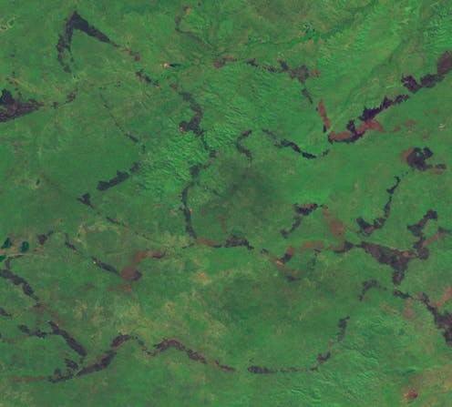
From April to June each year, fire managers – such as Traditional Owners, park rangers and pastoralists – aim to create small, “cool” fires with care and precision to reduce fuel loads before conditions get severe later in the dry season. This work, “painting” landscapes with fire, is constantly informed by satellite data.
The combination of space technology with Indigenous knowledge and the know-how of pastoralists and park rangers has been everyday practice across northern Australia for the past 20 years. Not only does this work produce some of the best fire management outcomes in the world, it also demonstrates how cutting-edge technology can inform local and traditional knowledge for environmental management.
The satellite view
In the early 2000s, researchers and land managers brought together by the Cooperative Research Centre for the Sustainable Development of Tropical Savannahs[1] realised satellite imagery could be of great help for fire management across Australia’s vast tropical savannas.
These landscapes have always been prone to fire. After First Nations people moved away (or were forced) from these areas over the course of the 20th century, savanna fires became more frequent and intense[2].
Satellite imagery had long been used to understand the extent and severity of fires and other landscape-altering events. But researchers realised it could also be used to manage those fires – if up-to-date imagery could be provided to the public on a daily basis.
The result was regularly updated maps of recently burnt areas distributed via a website launched in 2003, hosted by Charles Darwin University – North Australian Fire Information[3] (NAFI).
Twenty years on, NAFI’s maps of active fires and burnt areas underpin fire management across northern Australia. The maps are used for planning, response, implementation, and reporting.
Carbon credits and international attention
NAFI’s fire information also informs the federal government’s calculations for carbon credits related to reduced savanna burning[4], which many people across Australia’s north are using to generate income. Some of this income is then put back into work to reduce the extent and severity of fires.
NAFI fire data also inform the national Australian Fire Danger Rating System[5] so it can be more effectively applied by bushfire agencies in remote areas.
Read more: The world's best fire management system is in northern Australia, and it's led by Indigenous land managers[6]
The same data have provided evidence showing north Australia has had one of the most significant declines in fire[7] across any large landscape globally.
The successes of the NAFI service are drawing international interest[8] as a model for fire information in other fire-susceptible regions around the world.
Painting with fire
Most Australians have a poor understanding of the history of fire on this continent. Fire has been a key human–ecological force that shaped landscapes over tens of thousands of years.
Over the past 20 years, proactive use of fire for landscape management[9] has been revived in northern Australia.
Read more: We are professional fire watchers, and we're astounded by the scale of fires in remote Australia right now[10]
The scale of the work undertaken by Northern fire managers, particularly at this time of year when fuel load reduction burns are underway, is easy to see on NAFI.
Landscape-scale fire management, as applied in Northern Australia, is a sophisticated endeavour where science, technology and engineering support local knowledge.
Beyond science and technology
In a world rapidly being transformed by climate change[12], the skills required to make our societies sustainable and resilient involve more than just science and technology. Good environmental management will also require diverse, locally based skills and capacity to act.
Good fire management, as a case in point, requires an ability to blend skills and ways of thinking across multiple knowledge systems as well as a huge amount of hard work on the land.
Enabling easy, appropriately curated access[13] to satellite-derived land information – and training to understand it – is critical.
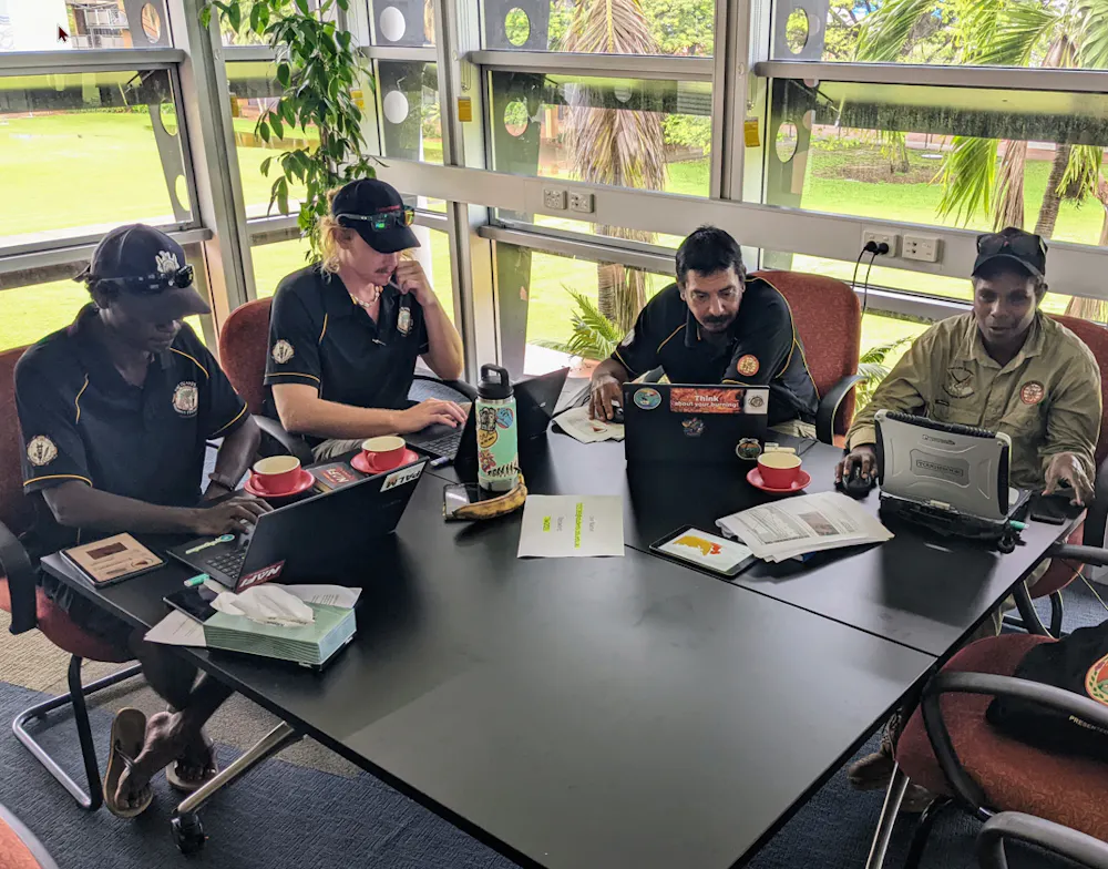
NAFI also develops and delivers training for land managers. Through workshops delivered across regional Australia, from remote Indigenous communities in the Kimberley and the top end to pastoralists in northern Queensland and central Australia, we are building high-tech capacity among those with the vital on-ground knowledge.
The journey of NAFI and fire management in northern Australia over the past 20 years illustrates how innovation is not just about technology, no matter how advanced. Innovation produces results when it is combined with other knowledge and put into the hands of the right people in the right way.
References
- ^ Cooperative Research Centre for the Sustainable Development of Tropical Savannahs (www.eoas.info)
- ^ became more frequent and intense (esajournals.onlinelibrary.wiley.com)
- ^ North Australian Fire Information (firenorth.org.au)
- ^ carbon credits related to reduced savanna burning (www.abc.net.au)
- ^ Australian Fire Danger Rating System (afdrs.com.au)
- ^ The world's best fire management system is in northern Australia, and it's led by Indigenous land managers (theconversation.com)
- ^ one of the most significant declines in fire (theconversation.com)
- ^ international interest (theconversation.com)
- ^ proactive use of fire for landscape management (theconversation.com)
- ^ We are professional fire watchers, and we're astounded by the scale of fires in remote Australia right now (theconversation.com)
- ^ NAFI (firenorth.org.au)
- ^ transformed by climate change (www.abc.net.au)
- ^ access (savannafiremapping.com)