Remarkable new tech has revealed the ancient landscape of Arnhem Land that greeted Australia’s First Peoples
- Written by: Jarrad Daniel Kowlessar, Associate Lecturer, Flinders University
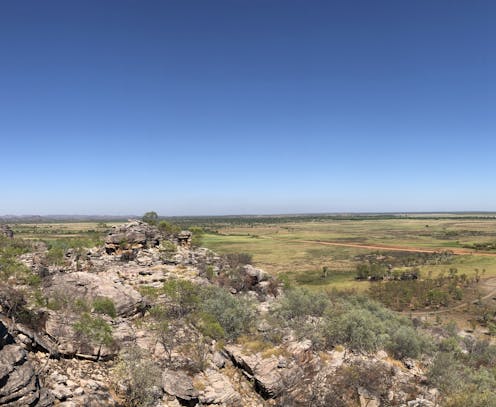
Many visitors to Arnhem Land in the Northern Territory are struck by the magnificent cliffs, stunning bird life and extraordinary rock art. Some may know this landscape includes the earliest evidence of human occupation in what is now Australia, at Madjedbebe, where signs of habitation have been dated to 65,000 years ago.
Most people, however, ignore the expansive floodplains surrounding these sites, especially when they are covered by water during the wet season.
Our research, recently published in PLOS One[1], shows these floodplains hide a complex landscape buried deep underground critical to understanding the deep history of the region. We have mapped the cliffs and rivers, more than 15 metres below the current surface, which would have greeted the first people to arrive here.
Red Lily Lagoon
This landscape has been transformed by a sea-level rise of more than 120 metres, which brought the coastline from more than 200 kilometres away to lap directly on the cliffs in the Red Lily Lagoon area in Western Arnhem Land.
Since then, the East Alligator River has filled this region with sediment and the coast has retreated 60 kilometres to the northeast, leaving the current landscape of jagged sandstone cliffs surrounded by flat floodplains, which are seasonally flooded.
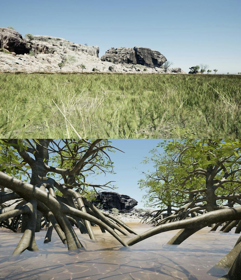
The buried landscape we have mapped contains a sandstone escarpment, now buried underground, which has great potential to contain archaeological sites. This overlooked a deep valley that contained a river system, which is now buried by more than 15 metres of sediment.
Eventually, around 8,000 years ago, this river system was flooded by sea-level rise, leading to mangroves filling the valley and levelling it with marine sediments built up between the roots of the mangrove trees.
These major changes in the local environments are also visible through materials excavated from Madjedbebe and other sites in the area.
The excavations show people in the area ate land animals and freshwater fish before the valley flooded. But afterwards, diets changed to take advantage of the ample supply of shellfish.
Read more: Buried tools and pigments tell a new history of humans in Australia for 65,000 years[2]
Modern maps of an ancient landscape
Previous work in Arnhem Land using drilling has provided some information about the history of the landscape, but our research achieves much greater detail.
Our work used a technique called electrical resistivity tomography. This is when we pass an electrical current through the ground to measure the nature of the sediments and rocks beneath the surface. This method can map more than 50 metres below the surface, and because it doesn’t involve digging or drilling, we could work right up to existing archaeological sites.
We combined this data with aerial mapping of the modern landscape undertaken with a drone and an airborne laser. This allows us to compare the subsurface results to the contemporary land surface and get a good understanding for just how much change has occurred up to the present day.
While geophysics techniques like these are often used to find and map archaeological sites, we instead focused on reconstructing the ancient landscape itself. Knowing how landscapes have changed provides important context for understanding choices people may have made about where to live, what to eat and how to move around.
What lies beneath?
This research paints a new picture of the landscape that greeted the First Peoples on their arrival. This older buried landscape, which is so different to the modern one, was occupied for most of the history of human activity in the area – starting over 60,000 years ago and lasting until just 8,000 years ago.
The past 8,000 years have seen dramatic changes, from a dry river valley to a mangrove forest to today’s seasonally inundated flood plains. These changes would have had important implications for people, including in terms of what they could eat and drink, and where they could live.
Some archaeologists have questioned the accuracy of the dates of occupation determined from the Madjebebe site. Criticism has focused on possible disturbance to the site by termite activity[3], and also the lack of other sites of a similar age[4] in the region.
Our research shows why a lack of other sites may not be surprising: the most likely places for people to have lived when they first occupied this area are now buried more than 10 metres beneath the floodplain.
‘We want people to see’
Beyond Red Lily Lagoon, the methods we have used will give archaeologists a low cost, non-invasive way to understand ancient landscapes on a broad scale. Better models of how the environment has changed let us ask new questions about how people lived.
This is useful, not just as a tool for understanding why sites are where they are but also how people may have responded to the landscape around them. For example, we may have a different view of a rock art panel if we can understand what the artist could see around them when they painted it.
This research also has important implications for First Nations people. Alfred Nayinggul, a senior Erre Traditional Owner from Arnhem Land and co-author of this research, said:
We want people to see and want people to know what’s been happening many thousand years ago in the past. We need to know where those other places in Australia are, and that it was different before, and how it was formed, and we didn’t know what it was. We need to know, us Bininj, and everyone in the world with this new technology, bringing that up to our country. I need to know, and the rest of the world would see, what was in the past.
References
- ^ PLOS One (doi.org)
- ^ Buried tools and pigments tell a new history of humans in Australia for 65,000 years (theconversation.com)
- ^ termite activity (onlinelibrary.wiley.com)
- ^ lack of other sites of a similar age (www.pnas.org)