Cyclone Ilsa just broke an Australian wind speed record. An expert explains why the science behind this is so complex
- Written by: Thomas Mortlock, Adjunct Fellow, UNSW Sydney
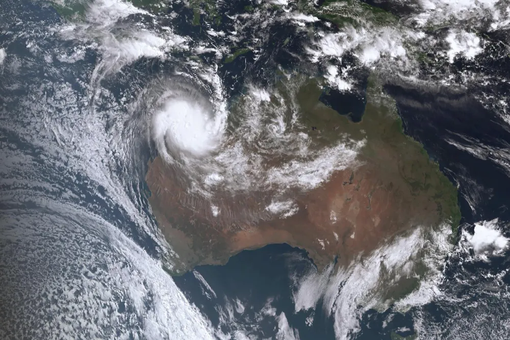
Tropical cyclone Ilsa has been downgraded to a category-three cyclone as it moves southeast through Western Australia[1]. The storm first made landfall as a category-five cyclone, passing near Port Hedland around midnight.
Ilsa smashed into the largely uninhabited Pilbara region (the country’s most cyclone-prone region[2]) at record-breaking speeds. It has delivered Australia’s highest ten-minute sustained wind speed record at landfall: about 218 kilometres per hour[3]. The previous record of 194km per hour came from tropical cyclone George in 2007.
So, does this new speed make Ilsa a particularly menacing disaster? The science of reporting on cyclone wind speeds is highly complex – and it can be easy to misconstrue the figures without some context.
Record-breaking sustained wind speeds
As Ilsa continues to move inland, it looks likely the storm will be further downgraded before it passes into the Northern Territory – and potentially over Alice Springs – later today and tomorrow.
Ilsa made landfall about 100km north of Port Hedland, which hosts the world’s largest export site for iron ore[4]. But a red alert prompted most vessels to be moved farther west in advance, so it only caused minor destruction.
Analysis by James Knight at Aon’s Reinsurance Solutions expects in general it will cause only minor damage due to the remoteness of where it has hit.
Apart from the ten-minute sustained record mentioned above, Ilsa had a one-minute sustained record of 240km per hour, and a three-second sustained record of 295km per hour.
It’s usually the latter, more intense gusts, that cause the most damage in tropical cyclone events. When it comes to making potential damage assessment for insurance purposes, firms will often model damage associated with a three-second sustained wind speed.
But there are several challenges that come with recording and making predictions about cyclone wind speeds.
Read more: Cyclone Freddy was the most energetic storm on record. Is it a harbinger of things to come?[5]
How are tropical cyclone winds recorded?
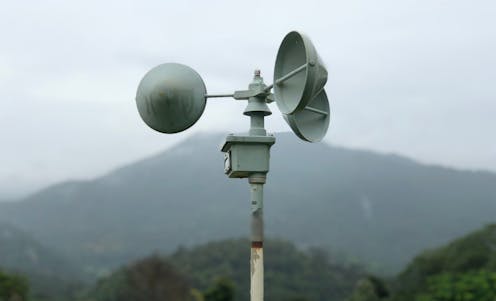
The Bureau of Meteorology maintains a national wind recording database[6], which uses instruments called anemometers. These measure wind speeds at locations across the country, and are often placed in flat areas, such as near airports.
Their specific placement is very important, because wind can change form as it moves over and through certain types of terrain.
Generally, when we report wind speed we’re referring to atmospheric wind gust, or wind speeds at least ten metres off the ground, which we also call “open terrain” wind speed.
However, wind passing closer to the ground, where the topography varies, will often be higher than winds passing directly above. Wind will speed up, for instance, if it’s squeezed between two hills.
We know from post-cyclone damage surveys that wind speeds can vary significantly from one side of a hill to another. So aspect and slope are very important.
As far as disaster modelling goes, this is no small issue as it can skew recordings. It’s quite possible there would have been wind gusts from Ilsa that exceeded what has been reported so far.
Australia lacks a sufficiently dense network of anemometers set up for long-term testing. If we want to gain insight into the frequency and intensity of extreme cyclone wind speeds over time, we’ll need a national quality-controlled network that has better spatial coverage.
The equipment we have, although it’s designed to withstand extreme conditions, can get knocked around and thrown offline – introducing data gaps in the time series.
Accurate and consistent data points are crucial if we want to record and predict the kinds of extreme winds we might experience during future tropical cyclones. And while the efforts of independent storm chasers and university groups do go some way, taking measurements from different sources can introduce a lot of uncertainty in the overall process.
Cyclone intensity will increase
Since 1975, there have been 48[7] category-five tropical cyclones to hit Australia – an average of about one per year. Shile Ilsa sets a new record for the strongest sustained wind gust at landfall, category-five tropical cyclones have been occurring with some regularity overall.
It’s worth mentioning Ilsa formed pretty late in the cyclone season. Although the Bureau of Meteorology says cyclones can form any time of the year, its very rare for this to happen outside of April.
Historical trends and climate change projections suggest the number of landfalling cyclones in our region will decrease over time. This has been consistent with real-world data, and puts Australia at odds with other regions of the world, where cyclone frequency is increasing.
However, most climate models also predict a greater proportion of these cyclones will be of a higher strength. The current scientific consensus is we’ll experience these events less often, but when we do, they will be more intense.
Read more: Anatomy of monster storm: how Cyclone Ilsa is shaping up to devastate the WA coast[8]
References
- ^ as it moves southeast through Western Australia (www.bom.gov.au)
- ^ cyclone-prone region (www.bom.gov.au)
- ^ 218 kilometres per hour (twitter.com)
- ^ the world’s largest export site for iron ore (www.tradewindsnews.com)
- ^ Cyclone Freddy was the most energetic storm on record. Is it a harbinger of things to come? (theconversation.com)
- ^ national wind recording database (www.bom.gov.au)
- ^ have been 48 (en.wikipedia.org)
- ^ Anatomy of monster storm: how Cyclone Ilsa is shaping up to devastate the WA coast (theconversation.com)