

Is it time for a Category 6 for super cyclones? No – warnings of floods or storm surges are more useful
- Written by Liz Ritchie-Tyo, Professor of Atmospheric Sciences, Monash University
When a tropical cyclone forms, people who live in its path anxiously monitor news of its direction – and strength. If a Category 5 storm with wind speeds of 250 kilometres per hour is heading for you, you prepare differently than you would for a Category 1 with wind speeds of 65 km/h.
In a hotter world, cyclones are expected to become less common but more intense[1] when they do form. That, according to new research[2], means it might be time to consider introducing a Category 6 to the hurricane scale used in the United States to better communicate the threat.
But do cyclone scales need a new category for more severe storms? Only one hurricane in the Western Hemisphere has yet gone past the 309 km/h winds the researchers nominate for a Category 6. And the whole idea of storm scales, including Australia’s own tropical cyclone scale[3], is that Category 5 storms are those likely to do catastrophic damage. It’s hard to see what a Category 6 could offer.
What is worth exploring is how we can better communicate what specific threats a given storm poses. Is it carrying more water than average, making flooding a bigger risk? Or are unusually intense winds likely to bring more water ashore in storm surges?
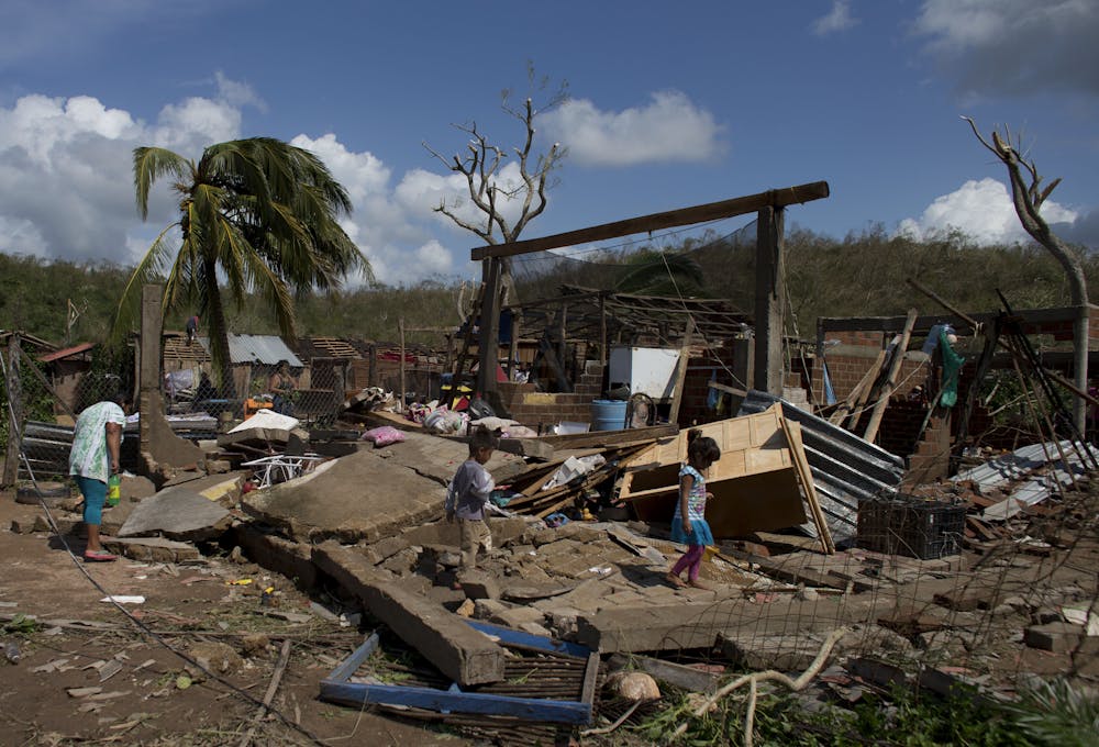
In December, Cyclone Jasper made landfall as a Category 2 storm in northern Queensland. Despite being at the lower end of severity, it dumped huge volumes of water and triggered devastating floods. Residents and farmers criticised the Bureau of Meteorology for not fully conveying the size of the threat[4]. More specific warnings could help.
What are storm scales for?
The world’s tropical cyclone warning centres[5] classify cyclones using simple intensity scale systems based on maximum wind thresholds. Cyclones, hurricanes and typhoons are different names for the same tropical storms.
There are several different intensity scales in use. The Saffir-Simpson scale[6] is used by the US National Hurricane Center[7] for hurricanes forming in the central and eastern North Pacific and North Atlantic basins. Different scales are used in the Australian, North Indian, Southwest Indian, and western North Pacific basins. Importantly, every scale in use is open-ended, meaning their final category is based on winds greater than a certain threshold – but with no upper limit.
Tropical cyclones can pose many threat to us while at sea, as they approach and make landfall, and even afterwards.
These threats include the intense winds near the eye of the tropical cyclone, the ring of damaging winds[8] which can extend hundreds of kilometres from the eye, wind-driven high seas, storm surge, heavy rainfall and associated flooding and mudslides.
We can’t say one of these is definitively more deadly or damaging than any other threat. Tropical Cyclone Oswald, a 2013 Category 1 storm, led to heavy rainfall and flooding through Queensland and New South Wales, while the 1992 Category 5 Hurricane Andrew caused catastrophic wind damage – but little rain or storm surge damage when it hit Florida.
Read more: Cyclone Ilsa just broke an Australian wind speed record. An expert explains why the science behind this is so complex[9]
So do we really need a Category 6?
The researchers suggest a Category 6 on the Saffir-Simpson scale would be for storms with winds over 86 metres per second (309 km/h).
They suggest five tropical cyclones have now passed that threshold since 2013. Certainly, Hurricane Patricia[10] (2015) would meet that threshold. But this is the only one which meets their criteria in the last 40 years, as it was well observed by US aircraft missions. The other four were not in the Western Hemisphere – they were typhoons affecting Asia. In these areas, meteorologists do not use aircraft reconnaissance to confirm wind speeds. Estimates of wind speeds can vary substantially. That means the wind speeds of these four cannot be verified.
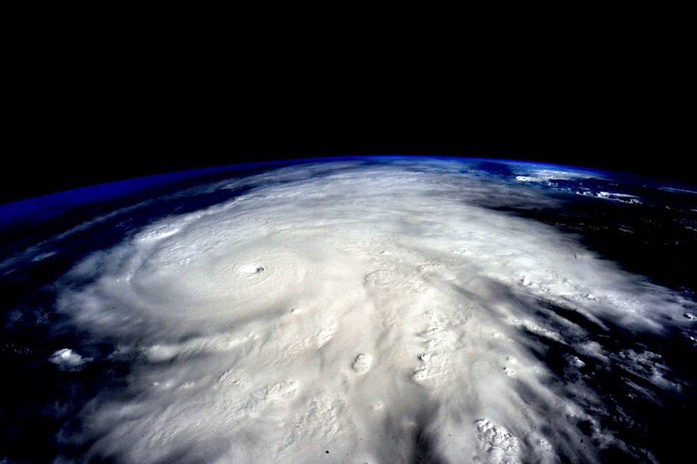 Hurricane Patricia in 2015 was the most intense storm ever recorded in the Americas. But do we need a new scale?
Scott Kelly/NASA/EPA[11]
Hurricane Patricia in 2015 was the most intense storm ever recorded in the Americas. But do we need a new scale?
Scott Kelly/NASA/EPA[11]
To make their case, the researchers also use the maximum possible intensity a tropical cyclone could reach in a given environment. It’s useful to scientists because it can be directly calculated from climate projections and is often used to explore how tropical cyclone intensity might change in the future. But it has an important limitation – tropical cyclones rarely reach[12] their maximum potential intensity.
In their original formulation of the Saffir-Simpson scale, Herb Saffir and Bob Simpson described a Category 5 hurricane making landfall as one which would cause catastrophic destruction of all infrastructure. The Australian Tropical Cyclone Scale[13] has different thresholds but similar reasoning for a Category 5 storm.
Based on the understanding that winds at Category 5 and above lead to catastrophic outcomes, it’s hard to see how adding a Category 6 would help the public. If a Category 5 means “expect catastrophic consequences”, what would Category 6 mean?
 Are there degrees of catastrophic damage? Hurricane Patricia made landfall in Mexico, destroying many buildings.
Rebecca Blackwell/AP[14]
Are there degrees of catastrophic damage? Hurricane Patricia made landfall in Mexico, destroying many buildings.
Rebecca Blackwell/AP[14]
How can we best communicate cyclone threats?
Scientists came up with tropical cyclone intensity scales as a way to clearly communicate the nature and size of the damage likely to occur. They are not intended to be comprehensive, as they’re based on a single wind speed valid only for the area near the eye, where the most intense winds occur.
Fundamentally, these scales are meant to measure how well our buildings and infrastructure can survive the wind force and also protect us. If our building codes, evacuation plans, and other protective strategies ever improved to the point where Category 5 storms no longer lead to catastrophic loss, it might make sense to introduce a Category 6. But we’re not at that point. The catastrophic loss from a Category 5 or Category 6 would look the same: catastrophic.
What we should do is explore whether we can improve the scale in different ways. Can we keep their simple, effective messages while also capturing the different threats a weather system like this can pose?
Read more: Even weak tropical cyclones have grown more intense worldwide – we tracked 30 years of them using currents[15]
References
- ^ more intense (www.ipcc.ch)
- ^ new research (www.pnas.org)
- ^ tropical cyclone scale (www.bom.gov.au)
- ^ size of the threat (www.abc.net.au)
- ^ tropical cyclone warning centres (community.wmo.int)
- ^ Saffir-Simpson scale (www.nhc.noaa.gov)
- ^ US National Hurricane Center (www.nhc.noaa.gov)
- ^ damaging winds (www.ga.gov.au)
- ^ Cyclone Ilsa just broke an Australian wind speed record. An expert explains why the science behind this is so complex (theconversation.com)
- ^ Hurricane Patricia (www.nhc.noaa.gov)
- ^ Scott Kelly/NASA/EPA (photos-cdn.aap.com.au)
- ^ rarely reach (journals.ametsoc.org)
- ^ Australian Tropical Cyclone Scale (www.bom.gov.au)
- ^ Rebecca Blackwell/AP (photos-cdn.aap.com.au)
- ^ Even weak tropical cyclones have grown more intense worldwide – we tracked 30 years of them using currents (theconversation.com)