The red and yellow sticker dilemma – how do we balance safety with the desire to return home after a disaster?
- Written by: Martin Brook, Associate Professor of Applied Geology, University of Auckland
Just over a month after the Auckland flood, and three weeks on from Cyclone Gabrielle hitting the North Island, the scale of the disasters and the rebuild is clear – as is a sense of being in limbo for those worst affected.
At Muriwai on Auckland’s west coast, locals were reportedly left frustrated by a lack of information[1] after a community meeting called by Auckland Council last week. So far, 113 homes have been “red-stickered” in the small settlement, with another 75 along Domain Crescent yet to be assessed due to the street’s ongoing instability.
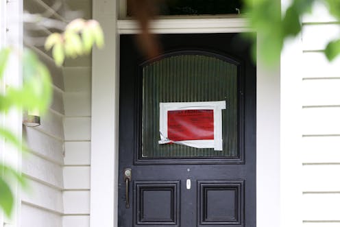
At the centre of it all sits section 124[2] of the New Zealand Building Act. This is the piece of law governing the red or yellow notices (“stickers”) pasted onto houses or buildings deemed “dangerous, affected, or insanitary”.
The situation now playing out at Muriwai provides a case study of the kinds of “pinch points” the use of section 124 can create for territorial authorities and their communities. The lessons learned should inform future disaster responses.
Listen to the science
Ultimately, councils want to keep people safe. But there can be tension when communities feel the risk from a hazard has diminished enough for them to return home and pick up their lives. Not least are concerns that a red sticker on the front of their house is an invitation to thieves.
Talk of “shutting the stable door once the horse has bolted” or “throwing the baby out with the bathwater” is often heard in the aftermath of a natural disaster. The storm has passed, the sun is shining and people want to return to what might seem a more benign environment.
Read more: Landslides and law: Cyclone Gabrielle raises serious questions about where we've been allowed to build[3]
But what is “safe” is vague, and everyone has their own interpretation of risk – including engineers. Some parts of Aotearoa recover faster than others, and councils have different ways of operating. So it’s important local authorities make balanced decisions by prioritising the science.
In Gisborne in November 2021, for example, widespread landslides occurred[4], including a substantial slip involving several residential streets. This transitioned into an earthflow, with the most mobile material probably characterised as mudflow.
Contractors quickly installed concrete blocks at the toe of the slope to stop any more debris sliding onto the road (see picture below). Disruption to the community was kept to a minimum.
Avoiding extremes
There are other examples, however, of government agencies and councils failing to keep people safe – or being over-zealous in their approach to hazard management and community safety.
Most infamously perhaps, in 1966 at Aberfan[5] in South Wales a saturated pile of coal “spoil” slumped and flowed down the valley side. The result of no effective monitoring at all, the slide engulfed a primary school and killed 144, including 116 children.
Read more: Massive outages caused by Cyclone Gabrielle strengthen the case for burying power lines[6]
Still in the UK but the other end of the scale, the Cumbria County Council acted very quickly in 2021 when cracks appeared[7] in the soil at the end of a hot summer at Parton on the Cumbria coast. The council evacuated the village[8] for more than a week, and the local school was only reopened 14 months later.
A klaxon warning alarm was installed as a precaution, but the geotechnical investigation showed there had actually been no recent movement of the slope at all. The “tension cracks” were more likely shrinkage cracks due to the soils drying out, not from tensional stresses within an unstable slope.
Both examples demonstrate the importance of understanding the true stability of a slope. Monitoring can be done by remote sensing from helicopter-borne LiDAR[9] (as at Muriwai at present), or space-borne InSAR[10]. But knowing what is happening to a slope means being able to see, in high resolution, its physical behaviour over time.
The technology exists
A good example of state-of-the-art monitoring[11] is the ALERT system pioneered by the British Geological Survey at the Hollin Hill landslide test site in North Yorkshire. This uses ground surface markers, with a variety of motion and listening sensors installed below in geotechnical boreholes at different depths within the slope.
Monitoring moisture is often the key, as rising soil moisture is often the precursor to any measurable slope movement. The installed sensors stream data directly to a geologist’s office computer, providing the basis for science-based decision-making.
Read more: Why a temporary flood levy on higher earners would be the fairest way to help pay for Cyclone Gabrielle[12]
The international mining industry has also pioneered the monitoring of unstable slopes within open-pit mines. A land-based radar unit is pointed at a slope and provides measurements in real time to a control room. Trigger levels are set so that movement beyond certain allowable thresholds raises an alarm and the pit floor is evacuated.
A classic example of its effectiveness is a landslide at Bingham Canyon Mine[13] in Utah in 2013. When radar detected slope movement above the acceptable thresholds, more than 100 workers were evacuated. A 60 million cubic metre rock avalanche occurred the next day. It was the largest non-volcanic landslide recorded in the US, and no one was harmed.
Finding the balance
Getting the balance right isn’t easy. Councils struggle to keep communities safe (recognising there is no such thing as zero risk) while also involving those communities in key decisions. It’s a dilemma local authorities and government agencies wrestle with across most OECD countries.
An approach to planning and mitigation of hazards based on te ao Māori[14] (the Māori world view) has been advocated, but it’s yet to be determined how this would play out across the Aotearoa’s varied communities and cultures.
Read more: 'Build back better' sounds great in theory, but does the government really know what it means in practice?[15]
But based on Muriwai’s experience, an agile and empathetic approach seems important. This would involve community participation in local hazard planning, coupled with rapid installation and application of state-of-the-art monitoring technology.
Anxious communities recovering from tragic events need to feel they are being listened to. Engaging them in the decision-making process – as well as demonstrating the science behind those decisions – is vital. This is especially so when people’s homes and lives depend on the application of section 124 of the Building Act.
References
- ^ frustrated by a lack of information (www.newshub.co.nz)
- ^ section 124 (www.legislation.govt.nz)
- ^ Landslides and law: Cyclone Gabrielle raises serious questions about where we've been allowed to build (theconversation.com)
- ^ landslides occurred (www.rnz.co.nz)
- ^ Aberfan (en.wikipedia.org)
- ^ Massive outages caused by Cyclone Gabrielle strengthen the case for burying power lines (theconversation.com)
- ^ cracks appeared (www.bbc.com)
- ^ evacuated the village (cumbriacrack.com)
- ^ LiDAR (www.neonscience.org)
- ^ InSAR (www.usgs.gov)
- ^ state-of-the-art monitoring (www.bgs.ac.uk)
- ^ Why a temporary flood levy on higher earners would be the fairest way to help pay for Cyclone Gabrielle (theconversation.com)
- ^ landslide at Bingham Canyon Mine (www.geosociety.org)
- ^ te ao Māori (ourlandandwater.nz)
- ^ 'Build back better' sounds great in theory, but does the government really know what it means in practice? (theconversation.com)